價格:免費
檔案大小:27.2 MB
版本需求:系統需求:iOS 13.0 或以後版本。相容裝置:iPhone、iPad、iPod touch。
支援語言:英語
Planning to climb Mount Snowdon? You’ll need to know two things, where to go and what the weather’s like – and Mount Snowdon Offline Map covers both
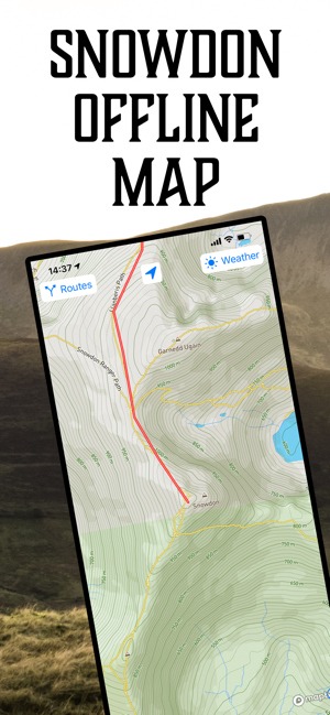
The perfect travel companion, Mount Snowdon Offline Map includes all six routes up the mountain pre-installed, so you don’t have to hunt around the internet for a GPS file. Just select your route and follow the red line all the way to the cafe at the top, it even works without an internet connection.
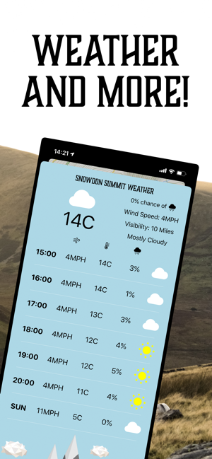
Mount Snowdon Offline Map also includes a detailed summit weather forecast for the next six hours and an overview of the weather tomorrow, so you can plan your journey and know what to expect on the way up and the way down.
Full features include:
- Full navigable map of Mount Snowdon and the surrounding area.
- Pinch to zoom to see more detail.
-Preinstalled route data for all six marked trails (Llanberis Path, Miners’ Track, Pgy Track, Watkin Path, Rhyd Ddu Path, Snowdon Ranger).
-Easily overlay your walking route over the map without having to download additional files from the internet.

- Offline compatibility, so you can navigate your way to the summit, even when you have low or no signal.
- Location tracking, so you can see exactly where on the mountain you are.
- Compass so you know which direction you’re facing.
- Comprehensive weather outlook for the summit over the next six hours, so you can be prepared for the changing weather at the top.
- Weather summary for tomorrow, so you can plan for what you’re walking into.
I climbed Mount Snowdon last year and it was an incredible experience. Mount Snowdon Offline Map will help you do the same, without having to worry about getting lost.
Map data from Mapbox
Additional graphics from Vecteezy.com